Researchers at Texas Tech's Center for Geospatial Technologies have developed what is a near-real-time map of the aftershocks occurring globally following the 8.9 magnitude earthquake that rocked Japan Friday.
According to Reuters: Kevin Mulligan, the Director of the Center, said the map was developed since there was a lack of new information presented on major news outlets. The map connects to near-real-time remote feeds from the United States Geological Survey's Earthquake Hazards Center and the National Oceanic and Atmospheric Administration's Tsunami Warning Center.
The map was constructed using Arc GIS and, according to Mulligan: "This map is a dynamic map surface that shows the distribution of recent earthquakes from a USGS live remote feed." It also has information about earlier earthquakes in the general area of Japan and allows you to view the information via different displays (topographic, street view, and others).
The map is very informative and can be accessed here.
We were given the link by a fellow Brown University grad and note that some of the best reporting regarding the evolving situation of the explosion at the nuclear power plant in northern Japan that was not cooled down sufficiently because of a system cooling failure post the earthquake is being done by Martin Fackler and Matthew L. Wald of The New York Times. Coincidentally, Matt is another Brown University grad. Their article on the Explosion Rocks Japan Nuclear Plant After Quake is a must-read. Being of Ukrainian heritage, I pray that the Japanese do not experience the same catastrophe as we did in Chernobyl. The Japanese have suffered enough.
About Me
- Dr. Anna Nagurney
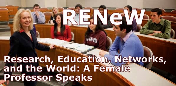
- Dr. Anna Nagurney is the Eugene M. Isenberg Chair in Integrative Studies at the Isenberg School of Management at the University of Massachusetts Amherst. She was appointed to this chaired professorship on April 14, 2021. Prior to this chaired professorship, since 1998, she was the John F. Smith Memorial Professor of Operations Management. She was a Visiting Fellow at All Souls College at Oxford University for the 2016 Trinity term. She was a Visiting Professor at the School of Business, Economics and Law at the University of Gothenburg in Sweden for 2012, 2013, 2014, and 2015. Her latest book is: Labor and Supply Chain Networks, published by Springer in 2023. Her other recent book, co-edited with I. Kotsireas, P.M. Pardalos, and A. Tsokas, is: Dynamics of Disasters: Impact, Risk, Resilience, and Solutions, and was published by Springer in 2021. She is also the co-author of the book: Competing on Supply Chain Quality: A Network Economics Perspective, with D. Li, and published in 2016. She is the Founding Director of the Virtual Center for Supernetworks, which she established in 2001.
Subscribe To RENeW


Labor and Supply Chain Networks
Dynamics of Disasters - Impact, Risk, Resilience, and Solutions

Dynamics of Disasters - Algorithmic Approaches and Applications

Dynamics of Disasters - Key Concepts, Models, Algorithms, and Insights

Competing on Supply Chain Quality
Networks Against Time: Supply Chain Analytics for Perishable Products
Fragile Networks: Identifying Vunerabilities and Synergies in an Uncertain World
Supply Chain Network Economics
Sustainable Transportation Networks

Supernetworks: Decision-Making for the Information Age

Innovations in Financial and Economic Networks
Environmental Networks: A Framework for Economic Decision Making and Policy Analysis
Financial Networks: Statics and Dynamics

Network Economics: A Variational Inequality Approach
Recent Visitors
Blog Archive
-
▼
2011
(275)
-
▼
March
(27)
- My Student, the President
- The SBP 2011 Tutorial Presentations Are Now Online!
- The Braess Paradox, Broadway, and Basketball
- SBP 2011 Conference Highlights Through Photos
- Would Proper Risk Assessment and Management Have M...
- Hope to See You at the Northeast Regional INFORMS ...
- Meet the Ford Executive
- Leadership in Transportation Honored by the Instit...
- Ecological Predator-Prey Networks as Nature's Supp...
- News Highlights from the Supernetwork Center
- Let's Build a Resilient Network Economy Through an...
- The Robustness of Global Supply Chains and the Dis...
- Photos from the Bement School Alum Service Trip to...
- Safely Back from Their Second Community Service Tr...
- Game Theory and Winner of Survivor -- An O.R. Surp...
- Isenberg School Doctoral Students in Management Sc...
- Near-Real-Time Map of Japan's Earthquake and After...
- Supply Chain Disruptions Post the Japanese Earthqu...
- Will a Tsunami Hit and, If So, Where?
- Real Generals Talk Logistics and Winning in the Gr...
- Diversity for Scientific Innovation
- Three Fabulous Plenary Speakers Confirmed for the ...
- My Interview on Italian Radio
- Legal Insights Gained from Computer Science
- What if Noone Showed Up to Your Talk!
- Analytics Research from Sports to Supply Chains at...
- Sustainable Fashion Supply Chain Management and Be...
-
▼
March
(27)